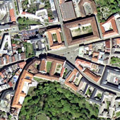
Ortofoto České republiky
| Informace o produktu | ||
|---|---|---|
 | Název | Ortofoto České republiky |
| Obchodní kód | 63410 | |
| Výdejní jednotka | mapový list SM 5 (2,5x2 km) | |
| Cena za jednotku | Bez poplatků | |
| Výdejní formáty | JPEG | |
| Souřadnicové systémy | S-JTSK / Krovak East North, ETRS89 / UTM zone 33N (N-E), ETRS89 / UTM zone 34N (N-E) | |
| Distribuce | 


| |
| Popis produktu | Digitální zdánlivě bezešvé ortofoto České republiky v barevné škále 8 bitů. Pixel rastrového obrazu Ortofota ČR zobrazuje 0,125 m území ve střední rovině terénu. U Ortofota ČR dochází ke stálému zlepšování polohové přesnosti charakterizované střední polohovou chybou, tato chyba se v letech 2019-2020 pohybovala v hodnotách 0,20 až 0,21 m, v letech 2021-2022 v hodnotách 0,19 až 0,20 m, jak je uvedeno v Technické zprávě k Ortofotu ČR. Ortofoto ČR je distribuováno v grafických rastrových formátech JPG po výdejních jednotkách o velikosti zobrazující 2,5 x 2 km terénu v kladu SM 5.Souborová data jsou poskytována ve formátu JPEG a doplněna o JGW soubory pro souřadnicové systémy S-JTSK, ETRS89-TM33N a ETRS89-TM34N. Pro stažení jsou sobory komprimovány (ZIP). | |
| Aktualizacni cyklus - stav aktualizace | Celá datová série je aktualizována ve 2letém cyklu. Ročně je aktualizována přibližně jedna polovina území ČR (od roku 2020 je při aktualizaci zohledňována hranice krajů). Stav aktualizace Plán aktualizace | |
| Podmínky přístupu a použití | Bez poplatků Licence Creative Commons CC BY 4.0 Dle Vyhlášky č. 31/1995 Sb. | |
| Prohlížení dat |
Mapová aplikace Služba WMTS Služba WMS | |
| Stahování dat |
Služba Atom Export výřezu dat Stažení předpřipravených souborů - výběr nad mapou | |
| Kontakt - informace o produktu | Zeměměřický úřad, e-mail: ZU-obchod@cuzk.gov.cz | |

Poslední aktualizace produktu:
2024-12-31
2024-12-31
Poslední aktualizace/revize informací:
2025-03-06
2025-03-06


 RSS 2.0 Geoportál ČÚZK