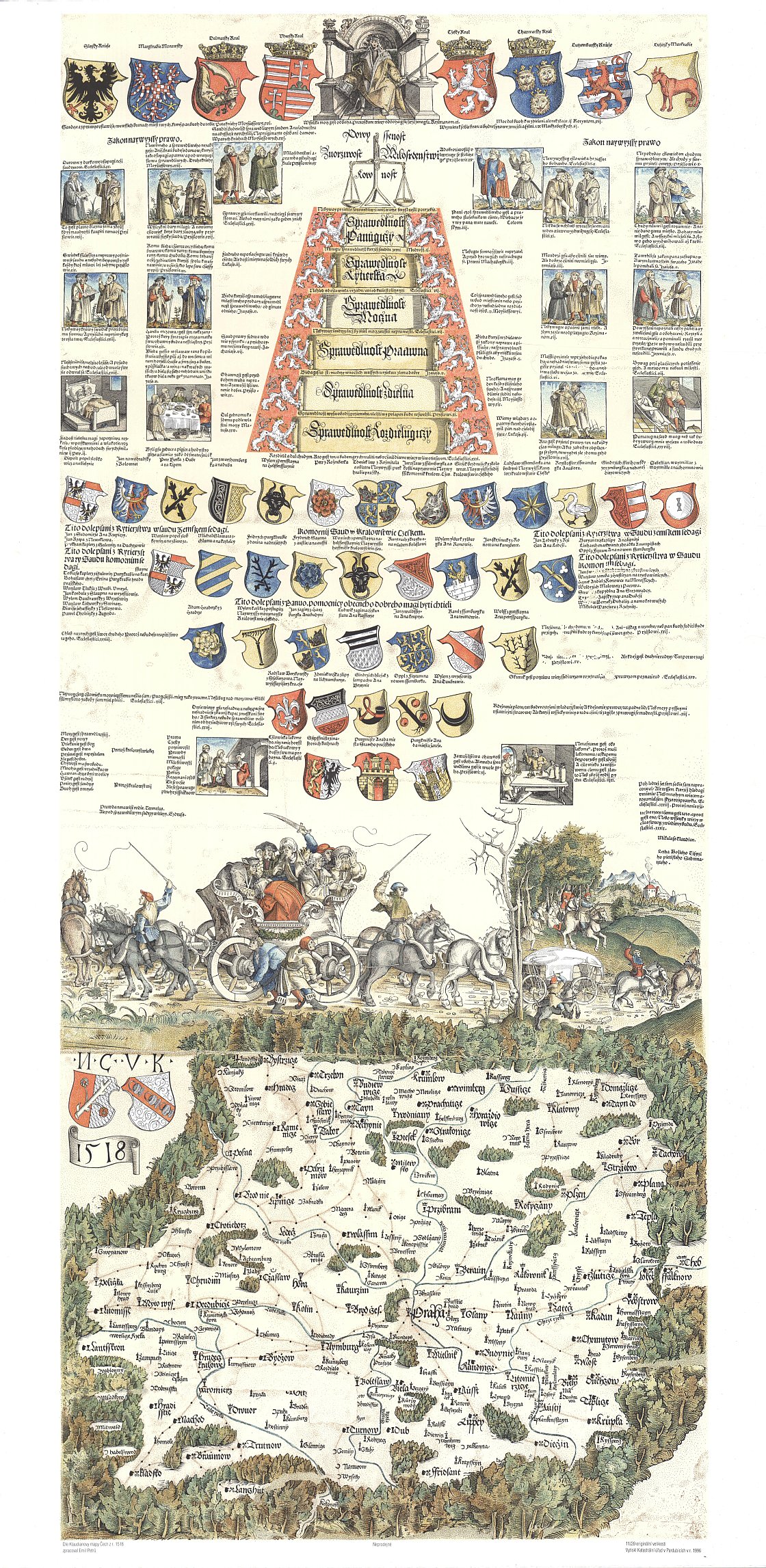
Klaudyánova mapa Čech z roku 1518
| Informace o produktu | ||
|---|---|---|
 | Název | Klaudyánova mapa Čech z roku 1518 |
| Obchodní kód | 632785 | |
| Výdejní jednotka | Čechy | |
| Cena za jednotku | Dle Vyhlášky č. 31/1995 Sb. | |
| Výdejní formáty | TISK | |
| Souřadnicové systémy | ||
| Distribuce | 
| |
| Popis produktu | Nejstarší známá samostatná mapa Čech a Kladska z roku 1518. Autor Mikuláš Klaudyán. Je orientována k jihu. Zobrazuje 280 sídel, vodstvo, porosty a hlavní dálkové cesty. Města jsou rozdělena na královská a poddanská, katolická a nekatolická. Názvosloví je české. Má bohatou heraldickou výzdobu. Dole znaky Kutné Hory, Prahy a Žatce. Výjev vozu taženého na dvě strany poukazuje na nábožensky rozdělenou českou společnost a výjev přepadaného kupeckého vozu na nedobré bezpečnostní poměry v zemi. Je to nejvzácnější česká kartografická památka. | |
| Aktualizační cyklus - stav aktualizace | Neaktualizuje se, jde o kopii archiválie. | |
| Podmínky přístupu a použití | Dle Vyhlášky č. 31/1995 Sb. | |
| Prohlížení dat | ||
| Stahování dat | ||
| Kontakt - informace o produktu | Český úřad zeměměřický a katastrální, e-mail: prodejna.map.praha@cuzk.gov.cz | |

Poslední aktualizace produktu:
1518-01-01
1518-01-01
Poslední aktualizace/revize informací:
2025-03-06
2025-03-06


 RSS 2.0 Geoportál ČÚZK