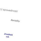
Databáze geografických jmen České republiky (Geonames)
| Informace o produktu | ||
|---|---|---|
 | Název | Databáze geografických jmen České republiky (Geonames) |
| Obchodní kód | 63710 | |
| Výdejní jednotka | stát | |
| Cena za jednotku | Bez poplatků | |
| Výdejní formáty | FGDB, GPKG | |
| Souřadnicové systémy | S-JTSK / Krovak East North, ETRS89 / UTM zone 33N (N-E) | |
| Distribuce | 


| |
| Popis produktu | Geonames je databází geografických jmen České republiky. Je systémem pro správu pojmenovaných objektů. Standardizované geografické jméno je vedeno v rámci popisných informací k cca 165 typům pojmenovaných geografických objektů. Geometrická reprezentace některých objektů Geonames odpovídá poloze geografického objektu vedeného v ZABAGED®, k němuž se jméno vztahuje. Další část objektů, především pozemkové tratě, lesní pozemky a místní části sídel, má zjednodušenou geometrii korespondující s umístěním popisu ve státním mapovém díle (SMD). Objekty jsou reprezentovány vektorovou (bodovou) složkou s atributy, které obsahují další informace o jménech. | |
| Aktualizační cyklus - stav aktualizace | Celá datová sada je aktualizována ve 3letém cyklu. Aktualizované verze jsou publikovány v měsíčním intervalu. | |
| Podmínky přístupu a použití | Bez poplatků Licence Creative Commons CC BY 4.0 Dle Vyhlášky č. 31/1995 Sb. | |
| Prohlížení dat |
Mapová aplikace Služba WMS | |
| Stahování dat |
Služba Atom pro data ve formátu FGDB Služba Atom pro data ve formátu GPKG Export výřezu dat Stažení předpřipravených souborů - výběr nad mapou Služba WFS | |
| Kontakt - informace o produktu | Zeměměřický úřad, e-mail: ZU-obchod@cuzk.gov.cz | |

Poslední aktualizace produktu:
2025-06-30
2025-06-30
Poslední aktualizace/revize informací:
2025-06-30
2025-06-30


 RSS 2.0 Geoportál ČÚZK