

Prohlížecí služba WMS - MČR 500
| Informace o produktu | ||
|---|---|---|
| Název | Prohlížecí služba WMS - MČR 500 | |
| Obchodní kód | Obchodní kód není stanoven | |
| Výdejní jednotka | Výdejní jednotka není stanovena | |
| Cena za jednotku | ||
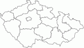
| Popis produktu | Prohlížecí služba WMS MČR 500 je poskytována jako veřejná prohlížecí služba nad daty Mapy České republiky 1:500 000.Služba splňuje standard OGC WMS 1.1.1. a 1.3.0. | |
| Vlastnosti služby | ||
| Lokalizace služby | https://ags.cuzk.gov.cz/arcgis1/services/ZTM/MCR500/MapServer/WMSServer | |
| Datové sady poskytované službou |
Poskytovaná data
| |
| Omezení a podmínky přístupu a použití | Zásady užívání dat a služeb ZÚ | |
| Prohlížení služby ve veřejném klientu |
Spustit službu | |
| Kontakt | Český úřad zeměměřický a katastrální, Křížek, Milan , tel: +420 284 047 430 , e-mail: milan.krizek@cuzk.gov.cz | |
Poslední aktualizace produktu:
2023-02-24
2023-02-24
Poslední aktualizace informací:
2025-03-06
2025-03-06
 RSS 2.0 Geoportál ČÚZK